
Trace a Norwood Street Directory
Address work in Norwood is a chain of separate records, not a single list of everyone on a block. Start with the current street number in the assessor card. That establishes the tax parcel and can supply the owner name, the physical address, and a Registry reference. From there, use the state parcel map for the parcel’s position, the Registry for the transfer trail, a properly limited Town Clerk request for voter-list material, and library collections for historic street snapshots.
- Search the address in the Norwood FY2026 assessment database. Record the situs address, map or lot details where shown, owner name, mailing address, and book or page reference without treating any one field as a household list.
- Use the Massachusetts Interactive Property Map to place that parcel among the surrounding street parcels. Save the parcel identifier and compare only the parcels actually touching the route under review.
- Search the owner and parcel reference through Norfolk Research or the Registry research route. Read the deed image, date, grantor, grantee, and legal description before connecting an old and current street number.
- For an address-specific civic question, ask the Norwood Town Clerk whether a public municipal voter list can be inspected or produced for the stated election or date. Request only public fields and ask about format and production cost.
- For past occupants, check the dated resident and business volumes at Morrill Memorial Library’s digital archive, then contact the Norwood Historical Society when its assisted house or family research may fill a collection gap.
Keep the sources in date order. A current tax card, an older deed, and a directory scan can all be accurate while describing different moments. The full historical shelf is available through the Norwood Directory Book.
Norwood Street Address Fields
The assessor card is the right first stop for a Norwood street search because it distinguishes the property’s location from tax correspondence. Massachusetts parcel standards separate owner and mailing fields from the full street, city, and ZIP fields. A mailed tax notice can go to a post office box, another town, an estate, a trust, or another state. It should never be copied into the field for the actual parcel location.
| Card detail | How to read it for a Norwood address |
|---|---|
| Tax owner and mailing fields | OWNER1 and the OWN_ADDR, OWN_CITY, OWN_STATE, and OWN_ZIP-style fields identify the tax-roll owner and mailing destination. They do not establish every person at the parcel. |
| Situs or site address | The FULL_STR, city, and ZIP-style fields identify the physical Norwood parcel. Use this address when matching permits, maps, directories, and Sanborn sheets. |
| Map, lot, parcel, and Registry references | These identifiers, including REG_ID, LS_BOOK, or LS_PAGE where supplied, help bridge a street search to a deed or plan when numbers have changed. |
| Assessment and property facts | The FY2026 card can show land, building, and total assessment values plus such facts as year built or zoning where displayed. FY2026 bills reflect ownership as of 2025-01-01 and use 2024 sales. |
A homestead exemption, if a card displays one, documents an exemption filing. It does not prove that every person associated with the address lives there. Treat the assessor card as parcel evidence first.
Note: Preserve the mailing and situs fields separately in a parcel worksheet so later deed and directory comparisons do not blend them.
Norwood Street Directory Property Search
Norwood’s Vision Government Solutions search route is intended for property address or street and owner-name research. The live interface is JavaScript-rendered, so the research did not verify every current label, filter, or format. Use the available address or owner route, open the result card, and record the fields actually displayed rather than assuming an unverified ZIP-wide search exists.
| Norwood assessor route | Input or result | Verified use |
|---|---|---|
| Property address or street | Text or autocomplete route | Find the situs parcel by a Norwood street address. |
| Owner name | Text route | Find an intended owner-name result, then confirm the physical situs on the card. |
| Map, lot, or parcel | Text route | Use when a deed or plan provides the parcel reference; exact local format was not captured. |
| Result card | Linked property record | Review owner, mailing and situs fields, value, and parcel facts where the card displays them. |
The assessment database is a fiscal record. It supplies a strong parcel starting point, but a tax owner can be a person, estate, trust, business, or municipality. The card is not evidence of every occupant.
Norwood Street Parcel Map
The Massachusetts Interactive Property Map provides the statewide address and parcel context needed to move along a Norwood street. Its available map tools should be used as displayed, because the research did not verify a formal Norwood radius, measure, or export control. Click the selected parcel and adjacent polygons one at a time, then open each related card separately.
The Massachusetts Interactive Property Map shows the public parcel and address context used for Norwood address research.
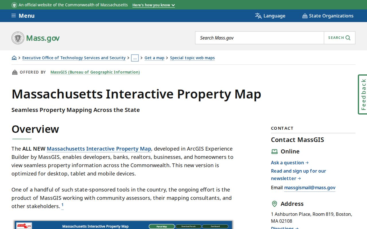
The map supplies spatial context. It does not prove that adjoining parcel owners form one household or have any relationship beyond nearby parcel boundaries.
For downloadable tax-parcel context and field definitions, consult the MassGIS property-tax parcel resource. The statewide material documents standardized parcel fields, while the VGSI card remains the local route for a current Norwood property record.
Norwood Street Deed Trails
The Norfolk Registry of Deeds holds land books and images reaching back to 1793. Recorded land and registered Land Court land use separate indexes, although the address route combines them. For a street search, the modern address result is most useful from 2003 forward. When an earlier address does not appear, switch to the owner name, town, recording date, book and page, plan, and legal description.
Norfolk Research displays the grantor, grantee, address, town, document, and date workflow used to connect a Norwood parcel to its deed trail.
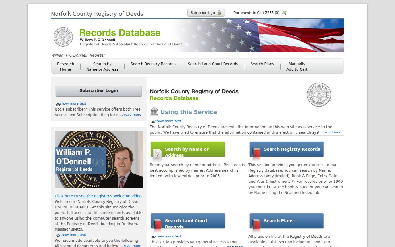
Search surname first, omit titles, and use a wildcard for spelling variants when needed. Municipal entries can appear as “Norwood Town of,” except Conservation Commissions. A plan search may use a street, surveyor, or owner, while book and page can locate a recorded document directly.
Registry research and view-only prints are free but carry a “not an official copy” overlay. The older Registry guide describes paid clean-copy options, so confirm the current fee schedule before requesting one. The Registry’s public-record request form is a direct option when a specific document cannot be obtained online.
Note: An address-only miss in an old deed index is not proof that the parcel lacks a prior deed record.
Norwood Street Voter Requests
Massachusetts has two different voter paths. The statewide Voter Registration Search requires first name, last name, full date of birth, residential ZIP, and an acknowledgment. It is not a street-browse tool. When the question is tied to an address or a historic local list, ask the Norwood Town Clerk about a paper or electronic municipal list for a named election or date.
The Clerk’s office is the local election contact and can explain what public fields, production cost, format, and use rules apply. Secretary guidance identifies public local-list fields that can include name, address, party or enrollment, status, registration date, prior changes, and election participation. Phone, email, confidential records, and minors are not public. The request should never ask the Clerk to disclose protected voter information.
Norwood Town Clerk contact details and current election-office information are available through the Secretary’s local election office directory. A public list is a dated civic record, not proof of day-to-day presence at an address.
Norwood Street Directory Records
Each address-keyed source answers a narrow question. Combining them too quickly creates false certainty. The best record trail preserves the parcel identifier, source date, and the difference between owner, registrant, applicant, and a historical directory appearance.
| Address record | Custodian | What it can establish | Access route |
|---|---|---|---|
| Assessment card | Norwood Assessor / VGSI | Tax owner, mailing and situs fields, assessment, and parcel facts | FY2026 online card; older cards may require office or library help |
| Parcel polygon | MassGIS | Parcel boundary, identifier, and map context | Public interactive map and parcel-data resource |
| Recorded deed or Land Court record | Norfolk Registry of Deeds | Transfer parties, recording date, book or certificate, and legal description | Online research, Registry request form, or counter research |
| Permit or monthly report | Norwood EnerGov / building offices | Address-based project timing and public applicant or owner fields where released | EnerGov, monthly report route, or a narrow request |
| Historic directory or newspaper | Morrill Library / Historical Society | Dated occupant, proprietor, business, or address clue | Digital archive, library help, or Society research contact |
Norwood’s abutters form is a different tool. It requests parties in interest and owner mailing addresses for a Chapter 40A process, not a casual street roster. It can be appropriate for its stated municipal purpose, but it does not convert a block into a list of residents.
Norwood Street Permit Clues
Norwood EnerGov is the municipal permit and licensing route. The captured research confirmed its registration and account controls but not a stable public field list, result range, or export mode. It is therefore a lead for address research, not proof that every historic permit is online or publicly visible.
A custom monthly building-permit report is also described in Norwood’s assessor support guidance. A permit date can help place construction, an addition, or other work in a parcel timeline. If the online route does not return the needed record, ask for existing permits for one street number and a defined year range, including the public permit date, type, applicant or owner fields, and final status.
This narrow request does not require staff to create a neighborhood database. It gives the custodian a record type, address, time span, and electronic-delivery preference.
Norwood Street Name Changes
Historic street searching needs a local date check. Norwood was incorporated from South Dedham in 1872, so older material may be cataloged or worded under South Dedham. A pre-1872 surname, business name, deed, or directory clue should be tried with that earlier place name before treating a search failure as final.
Washington Street has a second continuity problem. The Norwood Historical Society describes the railroad overpass and route change of 1897, with older Washington Street behind the current area. Its articles connect old numbers, businesses, families, directory references, Census clues, and deeds. For an old number that no longer fits, use the cross street, business name, owner surname, Sanborn sheet, and legal description as bridges.
The Street Directory method works best when it allows a historic address to change shape. A precise legal description or plan may carry the parcel identity farther than a modern street string.
Note: A modern number should not be forced onto a pre-overpass address without a deed, map, or directory link.
Norwood Street Directory Archives
Historic reverse or criss-cross work belongs at the library and Society, not in a present-day parcel card. In a criss-cross approach, start with the street in a resident or business section, note each number and name, then check the surname section and nearby years. A directory is a dated snapshot. It can show a resident, proprietor, or business clue, but it does not prove title or every member of an address.
The Morrill Memorial Library digital archive includes newspapers, annual reports, yearbooks, municipal records, and genealogy links. The Norwood Historical Society resources identify assessor cards, directories, newspapers, deeds, probate, cemetery material, and house or family research. The Society notes that its archives may not contain every family or property.
State Library holdings and Walpole scans supply selected Norwood directory runs. Pair a directory year with a Census schedule, newspaper, Sanborn map, or deed rather than treating a missing volume as evidence that an address was empty.
Norwood Address Record Requests
When an online search stops, ask the office that holds the record. The Registry can be approached through its research tools, counter, and document request form. The Town Clerk can address local election and municipal-record custody. Morrill and the Historical Society provide collection and research channels for older materials. Each path needs a precise description, such as a street number, record type, date span, parcel reference, name, or deed book and page.
For existing municipal material that is not posted online, use a written request under the Massachusetts Public Records Law, M.G.L. c. 66, § 10. Written requests are recommended, and a records access officer generally responds within 10 business days. Request electronic delivery when practical and accept lawful redactions. A denial should identify the exemption and appeal route.
MassGIS property-tax parcel data documents the parcel fields that can help make a request clear.
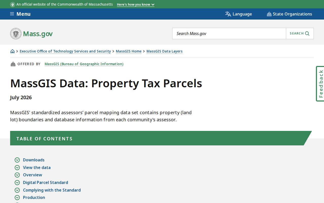
Using a parcel identifier, situs address, and date range together gives Norwood staff a better chance to locate the correct existing record without guessing about a household.
Note: A focused address request is easier to locate than a broad request for names connected with an entire Norwood street.
Limits of Norwood Street Searches
A property owner is not every person at a location. A parcel map proves geography, not a relationship. The assessor, Registry, permit route, voter records, directories, and public maps each have their own date and access limits. They do not identify every non-owner, visitor, utility customer, protected voter, or participant in the Address Confidentiality Program.
For corrections or restricted information, contact the appropriate custodian. The Massachusetts Address Confidentiality Program and confidential-voter rules protect eligible people through separate procedures. A missing result may reflect a privacy rule, a date gap, an old address, or a limited index, not a conclusion about a person.